You are using an out of date browser. It may not display this or other websites correctly.
You should upgrade or use an alternative browser.
You should upgrade or use an alternative browser.
maps
- Thread starter sufi
- Start date

sufi
lala
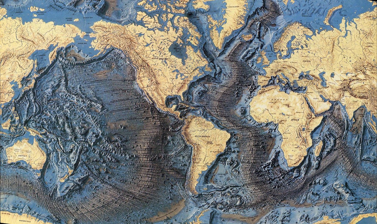
i'd like one of the ocean floor in the style of a tube map, showing all the currents and migrations, pleaseApparently this is a map of the ocean floor,
version
Well-known member
There's nothing quite like that, but there's some cool stuff from above.i'd like one of the ocean floor in the style of a tube map, showing all the currents and migrations, please

sufi
lala
This is brilliant, like a planet-sized van Gogh.
zoomin out
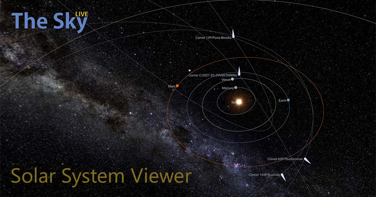
3D Solar System Viewer | TheSkyLive.com
Visualize orbits, relative positions and movements of the Solar System objects in an interactive 3D Solar System viewer and simulator.
 theskylive.com


sufi
lala
kinda like:i'd like one of the ocean floor in the style of a tube map, showing all the currents and migrations, please

version
Well-known member
Nah, it just says 'Loading tweet... ' and I click through to see it on Twitter.do you see embedded tweets?
Slothrop
Tight but Polite
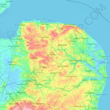
Going for walks during lockdown, I've got weirdly obsessed with this topographic map of the UK:
 en-gb.topographic-map.com
I think that what makes it interesting is that it re-scales the vertical axis as you drag and zoom, so rather than just having most of South East England labelled as "flat", you can zoom in and see the little micro-ridge systems that underly all the small inclines that you notice North London or Cambrigeshire or wherever.
Norfolk topographic map, elevation, terrain
Average elevation: 23 m • Norfolk, England, United Kingdom • Visualization and sharing of free topographic maps.
I think that what makes it interesting is that it re-scales the vertical axis as you drag and zoom, so rather than just having most of South East England labelled as "flat", you can zoom in and see the little micro-ridge systems that underly all the small inclines that you notice North London or Cambrigeshire or wherever.
jenks
thread death
It’s the kind of detail that you notice when cycling- the ridges and folds of the land that travelling in a car flattens out. Also most of my routes are quiet roads and lanes - the tracks that have essentially been pathways forever as opposed to bulldozed A roads. That sense of a link between history and geography is particularly strong once you get away from towns and into the country.Going for walks during lockdown, I've got weirdly obsessed with this topographic map of the UK:
Norfolk topographic map, elevation, terrain
Average elevation: 23 m • Norfolk, England, United Kingdom • Visualization and sharing of free topographic maps.
I think that what makes it interesting is that it re-scales the vertical axis as you drag and zoom, so rather than just having most of South East England labelled as "flat", you can zoom in and see the little micro-ridge systems that underly all the small inclines that you notice North London or Cambrigeshire or wherever.
Murphy
cat malogen
william_kent
Well-known member


jenks
thread death
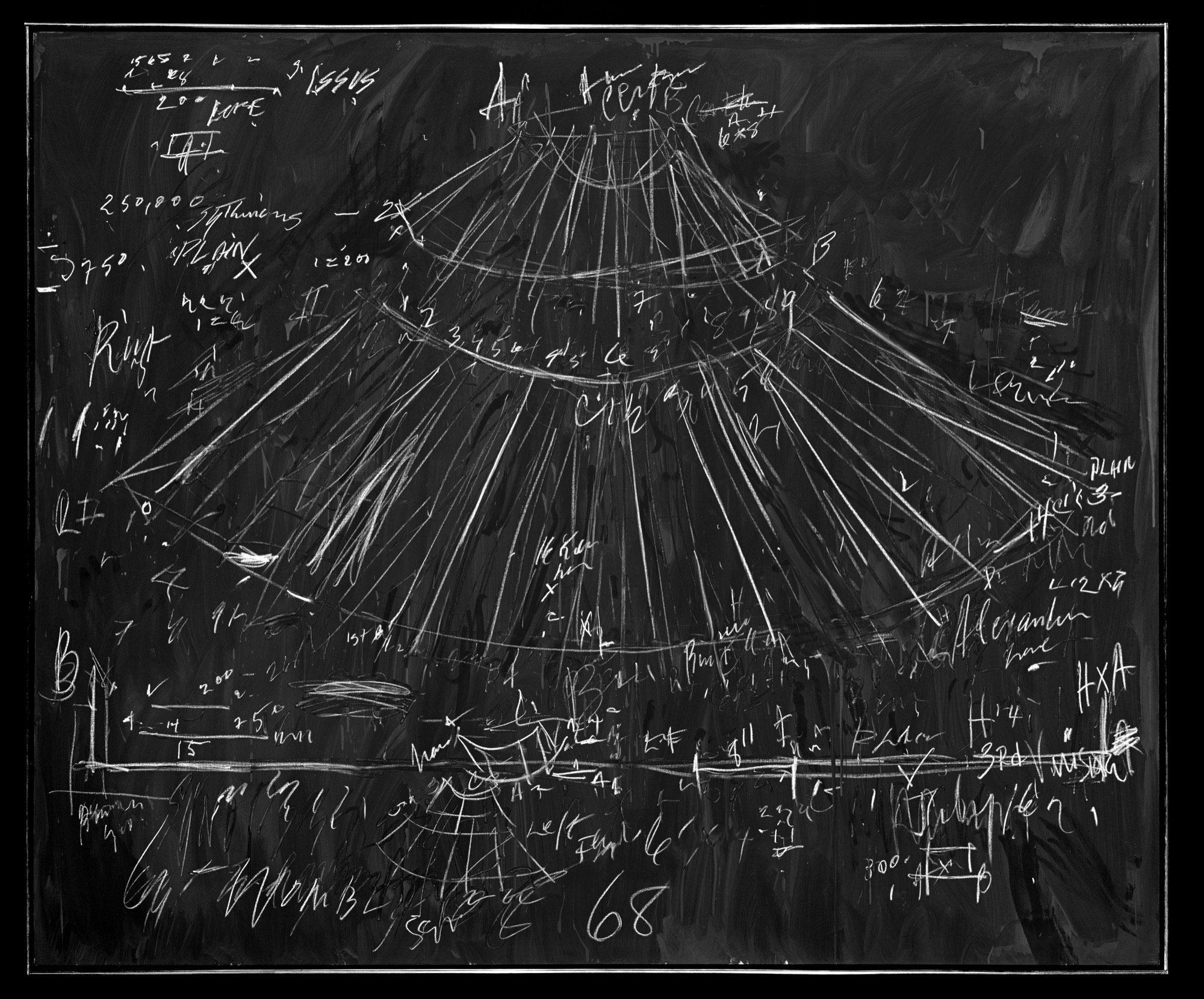
Remember seeing one of these at a British Museum exhibition looking at ideas about memory:
"The rebbelib were used for centuries, but they're not particularly good as a visual map. They're not to scale, and someone unfamiliar with this type of map would have trouble using one to navigate. And that's because the important information contained in the map isn't the location of the islands. The bamboo sticks that make up the frame also represent ocean currents and wind patterns, which Marshallese sailors use as navigation guides."

"The rebbelib were used for centuries, but they're not particularly good as a visual map. They're not to scale, and someone unfamiliar with this type of map would have trouble using one to navigate. And that's because the important information contained in the map isn't the location of the islands. The bamboo sticks that make up the frame also represent ocean currents and wind patterns, which Marshallese sailors use as navigation guides."